

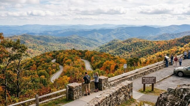
The Blue Ridge Parkway doesn’t try to get you anywhere fast, and that’s entirely the point. Stretching 469 miles through the Appalachian Mountains of Virginia and North Carolina, with a speed limit that rarely exceeds 45 mph and frequently drops lower through its curviest sections, this is America’s longest linear park — designed from the start as a scenic drive rather than a transportation corridor. No billboards, no commercial traffic, just ridgeline views, mountain overlooks, and small communities that have shaped Appalachian culture for generations.
This guide covers the full route from Shenandoah National Park to Great Smoky Mountains National Park, current 2026 road conditions, and how to plan a trip that matches your available time. If you’re building a broader Eastern road trip, this pairs naturally with other major U.S. routes — see our Route 66 road trip guide and Pacific Coast Highway guide for comparison if you’re weighing different regions of the country for a road trip this year.
Table of Contents
The Blue Ridge Parkway connects Shenandoah National Park in Virginia at its northern end to Great Smoky Mountains National Park in North Carolina at its southern end, running entirely free of charge — there’s no entrance fee for the Parkway itself, unlike the national parks it connects.
Current Blue Ridge Parkway Road Conditions for 2026
This is genuinely important to address upfront, since the Blue Ridge Parkway is prone to both seasonal weather closures and ongoing construction projects that can affect trip planning more than first-time visitors expect.
A major $75 million infrastructure project in the Roanoke, Virginia corridor (roughly milepost 97 to milepost 121) is ongoing through 2026, involving slope stabilization, road resurfacing, and drainage repairs. The project has shifted from single-lane closures to a full closure in parts of this stretch, with target completion for both project phases set for fall 2026. If your route passes through this section, check the official NPS Blue Ridge Parkway road closures page before finalizing your itinerary, since detour routes are in place but add real time to your drive.
A separate section near Bedford, Virginia (milepost 86 to 89) closed in March 2026 for pavement reconstruction and drainage repairs, with completion targeted for summer 2026. A signed detour routes around this closure via VA Route 43 and US Route 460.
Beyond planned construction, the Blue Ridge Parkway remains open 24 hours a day, 365 days a year as a baseline policy, but winter weather regularly triggers temporary closures — including a parkway-wide preemptive closure in January 2026 ahead of an incoming winter storm. Given the route’s elevation range, from under 1,000 feet to over 6,000 feet at its highest points, weather conditions can vary dramatically across different sections of the same drive on the same day.
Practical takeaway: always check current conditions close to your departure date, and don’t assume a closure you read about months ago is either still in effect or fully resolved. The Blue Ridge Parkway Association’s conditions page is updated regularly and worth bookmarking for the duration of trip planning.
Planning Your Blue Ridge Parkway Route: Direction and Duration
Direction: Most travelers drive north to south, starting near Shenandoah National Park in Virginia and ending at Great Smoky Mountains National Park in North Carolina, though the route works equally well in reverse. Northbound or southbound matters less here than on a coastal route like the Pacific Coast Highway, since the Blue Ridge Parkway’s views aren’t as dependent on which side of the road you’re driving on.
Duration: Driving the full 469 miles without stopping takes roughly 10-11 hours of pure driving time given the consistently low speed limits. Almost nobody does this in one push — most experienced travelers recommend 4-7 days to actually stop at overlooks, hike a few trails, and explore towns along the route rather than just passing through.
The Blue Ridge Parkway Route, Section by Section
Shenandoah National Park to Roanoke (Mileposts 0-120)
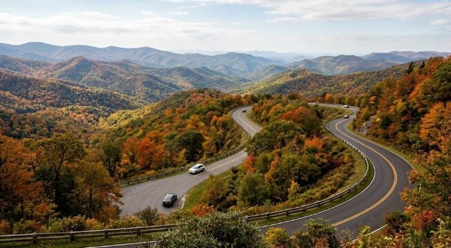
The Parkway’s northern section begins where Shenandoah National Park’s Skyline Drive ends, immediately establishing the route’s character: ridgeline views, frequent overlooks, and a noticeably slower pace than typical highway driving. The Peaks of Otter area, with its distinctive twin-peak silhouette, ranks among the most photographed stretches of this northern section. Given the ongoing Roanoke corridor construction covered above, this section requires the most current-conditions checking of any part of the route in 2026.
Roanoke to Blowing Rock (Mileposts 120-290)
This middle stretch crosses into North Carolina and passes through some of the Parkway’s highest-elevation terrain, including Grandfather Mountain’s dramatic profile, visible from multiple overlooks even though the mountain itself sits on a separate, privately managed section requiring its own entrance fee for direct access. The town of Blowing Rock offers a strong overnight base with considerably more dining and lodging options than the more remote stretches immediately north and south of it.
Blowing Rock to Asheville (Mileposts 290-380)
Asheville anchors this section as the Parkway’s largest and most amenity-rich city, worth a dedicated day or two beyond just a pass-through stop, given its strong food and craft beer scene layered onto its mountain-town setting. The Folk Art Center and numerous overlooks throughout this stretch showcase Appalachian craft traditions alongside the mountain scenery.
Asheville to Great Smoky Mountains National Park (Mileposts 380-469)
The Parkway’s southern terminus connects directly into Great Smoky Mountains National Park, the most-visited national park in the entire U.S. system. This final stretch includes some of the route’s highest elevations, with Richland Balsam at milepost 431 marking the highest point on the entire Blue Ridge Parkway at over 6,000 feet.
Sample Itinerary: 5 Days, Shenandoah to the Smokies
Day 1: Enter at the Parkway’s northern start, explore Peaks of Otter, overnight near Roanoke (checking current construction-related routing for this section before departure).
Day 2: Continue south toward Blowing Rock, stopping at overlooks along the way, overnight in Blowing Rock.
Day 3: Visit Grandfather Mountain, continue to Asheville, settling in for two nights given the city’s range of activities.
Day 4: Full day in Asheville — Folk Art Center, downtown exploration, and any of the area’s well-regarded breweries or restaurants.
Day 5: Final stretch south to Richland Balsam and the Parkway’s terminus at Great Smoky Mountains National Park, with time to begin exploring the Smokies if your trip extends further.
Best Time to Drive the Blue Ridge Parkway
Spring (April-May) brings blooming rhododendrons and dogwoods at varying elevations as the season progresses up the mountainside, plus generally manageable crowds compared to fall’s peak season.
Summer (June-August) offers full road access (barring any active construction) and warm weather, though higher elevations stay notably cooler than surrounding lowland areas — a detail worth knowing if you’re packing based on regional summer heat expectations rather than the Parkway’s actual elevation-driven climate.
Fall (September-October) is widely considered the single best season for the Blue Ridge Parkway, as fall foliage transforms the entire route into one of the most celebrated leaf-peeping drives in the country. This is also, unsurprisingly, the most crowded season, with weekend traffic at popular overlooks during peak color weeks (typically mid-October, though timing shifts year to year based on weather) requiring real patience and, ideally, weekday visits if your schedule allows flexibility.
Winter (November-March) brings the highest risk of weather-related closures, as covered in the road conditions section above, but also the quietest visitor numbers and a genuinely striking, stark beauty to the bare ridgelines and occasional snow-dusted overlooks.
Top Stops and Activities Along the Blue Ridge Parkway
Mabry Mill (milepost 176) is among the most photographed single locations on the entire Parkway, an still-operating water-powered gristmill that’s become an iconic symbol of the route’s Appalachian heritage.
Linn Cove Viaduct (milepost 304), an engineering landmark that wraps around Grandfather Mountain’s steep terrain, represents one of the most complex bridge construction projects in the Parkway’s history and remains a popular photography stop specifically for the bridge’s distinctive curved design against the mountain backdrop.
Craggy Gardens (milepost 364) offers some of the best wildflower displays along the entire route, particularly the native rhododendron blooms typically peaking in mid-to-late June.
Mount Mitchell State Park, accessible via a short detour near milepost 355, contains the highest peak east of the Mississippi River, offering a worthwhile side trip for visitors wanting the area’s most dramatic elevated views.
What to Pack for a Blue Ridge Parkway Road Trip
Layers regardless of season, given the Parkway’s dramatic elevation range — temperatures at Richland Balsam’s 6,000+ foot elevation can run 15-20 degrees cooler than valley towns along the same day’s route.
A full tank of gas before remote stretches, since fuel stations are sparser along the Blue Ridge Parkway itself than on standard highways, concentrated mainly in towns like Roanoke, Blowing Rock, and Asheville rather than evenly distributed.
Patience for the consistently low speed limit, which rarely exceeds 45 mph and drops further through curvier sections — this isn’t a route for covering ground quickly, and fighting that pace defeats much of the trip’s purpose.
Offline maps as backup, given limited cell service through significant stretches of mountainous, low-population terrain along the Blue Ridge Parkway.
Rain gear and sturdy footwear if any hiking is planned, since mountain weather along the route shifts quickly and trail surfaces can turn slick with little warning, particularly at higher elevations.
Hiking Trails Along the Blue Ridge Parkway
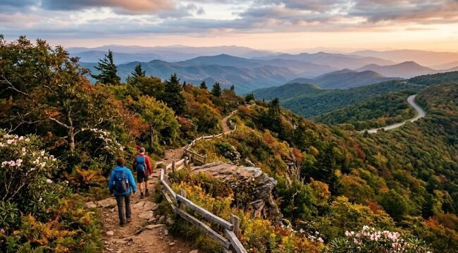
The Blue Ridge Parkway connects to hundreds of miles of hiking trails ranging from short overlook walks to multi-day backcountry routes, including direct connections to the Appalachian Trail at several points.
Rock Castle Gorge Trail, near milepost 167, offers a strenuous but rewarding loop through old-growth forest and past historic homestead sites, a strong option for hikers wanting genuine backcountry mileage without leaving the Parkway corridor.
Craggy Pinnacle Trail, a short but steep 1.4-mile round trip near milepost 364, rewards hikers with one of the most expansive 360-degree summit views along the entire route, particularly striking during the rhododendron bloom covered above.
Linville Falls Trail, near milepost 316, leads to multiple viewpoints of a dramatic multi-tier waterfall, with options ranging from an easy overlook walk to a longer, steeper route down to the base of the falls.
Appalachian Trail access points exist at several Parkway crossings, allowing day hikers to sample short sections of the famous long-distance trail without committing to a multi-day thru-hike — the Appalachian Trail Conservancy’s official site has detailed access point maps if a Parkway-to-AT connection interests you.
A Bit of History
The Blue Ridge Parkway’s construction began in 1935 as a Depression-era public works project, employing thousands of workers over more than five decades — the final section, the Linn Cove Viaduct around Grandfather Mountain, wasn’t completed until 1987, making this one of the longest construction timelines of any major American infrastructure project. The route was deliberately designed by landscape architects rather than highway engineers, prioritizing scenic overlooks and a contoured path that follows ridgelines specifically for visual impact rather than the most direct or efficient route between its endpoints.
This design philosophy explains much of what makes the Blue Ridge Parkway feel different from a standard scenic highway — every overlook, curve, and elevation change reflects an intentional design choice aimed at maximizing the views rather than minimizing drive time. The route also preserves and showcases Appalachian cultural heritage throughout its length, with sites like Mabry Mill and numerous historic farmsteads maintained specifically to reflect the mountain communities that predated the Parkway’s construction.
What a Blue Ridge Parkway Trip Costs
Lodging varies considerably by location, with towns like Asheville and Blowing Rock offering a full range from budget motels to higher-end mountain resorts, while more remote stretches of the route have genuinely limited options, making advance booking meaningfully more important than on routes with denser lodging availability throughout.
Fuel costs run comparable to a standard road trip of similar mileage, though the sparser distribution of gas stations directly along the Parkway itself (as opposed to nearby towns) means planning fill-ups around towns like Roanoke, Blowing Rock, and Asheville rather than assuming convenient mid-route options.
A realistic budget for a 5-day Blue Ridge Parkway trip for two people, with mid-range lodging concentrated in towns along the route and moderate dining, typically lands in the $1,200-1,800 range, not including flights to a starting point like the Washington, D.C. or Charlotte areas.
Gateway Towns and Where to Stay
Asheville, North Carolina functions as the Blue Ridge Parkway’s largest and most amenity-rich stop, with a genuinely strong independent food scene, numerous craft breweries, and enough cultural attractions to justify a multi-day stay beyond just a Parkway pass-through. The Explore Asheville official tourism site has current event listings and dining recommendations if you’re planning extended time here.
Blowing Rock, North Carolina offers a smaller-scale but well-equipped mountain town experience, considerably less commercial than Asheville while still providing solid dining and lodging options for a Parkway-focused trip.
Roanoke, Virginia anchors the route’s northern-to-middle section, with more standard city amenities than the smaller mountain towns further south, making it a practical overnight stop particularly relevant in 2026 given the active construction in this corridor.
Galax and Floyd, Virginia, smaller communities along the route’s northern Virginia stretch, offer a deeper dive into Appalachian musical heritage specifically, with regular old-time and bluegrass music gatherings that reflect the cultural traditions the Parkway was partly designed to showcase.
If you’re weighing a Blue Ridge Parkway trip against other regional options, this Appalachian mountain route offers a genuinely different pace and character than urban destinations like our New York City guide or entertainment-focused trips like our Las Vegas guide — worth considering if you’re choosing between a slower, nature-focused trip and a faster-paced city experience for the same travel window.
Wildlife Along the Blue Ridge Parkway
The Blue Ridge Parkway’s mixed forest and ridgeline terrain supports a genuine diversity of wildlife, though sightings require patience and, ideally, early morning or evening timing when animals are most active. White-tailed deer are commonly visible throughout the route, particularly in meadow areas near overlooks. Black bears inhabit much of the surrounding forest, most frequently spotted in spring and early summer though rarely at close range given the animals’ general wariness of road traffic. Wild turkeys and a wide range of songbirds round out the route’s more easily observed wildlife, with the Parkway’s varied elevation creating distinct habitat zones that support different species at different points along the 469-mile route.
As with any national park unit, visitors should maintain safe distances from all wildlife and never approach or feed animals along the Blue Ridge Parkway, both for visitor safety and to avoid habituating wildlife to human contact, a problem that creates lasting management challenges for park staff.
Common Mistakes to Avoid on the Blue Ridge Parkway
Treating the Blue Ridge Parkway as a fast way to get from point A to point B. The consistently low speed limits and frequent overlooks mean this route takes meaningfully longer than a standard highway covering the same distance — fighting that pace misses the entire point of driving it.
Not checking current construction and weather conditions before departure. Given 2026’s active Roanoke corridor project and the route’s general susceptibility to weather closures, assuming any single source’s information stays current for months is a real planning risk.
Skipping Asheville in favor of just driving through. The city offers genuinely strong food, craft beer, and cultural attractions beyond what most Parkway overlooks alone provide, and travelers who treat it as just another mile marker often regret the missed time afterward.
Underestimating fall foliage season crowds. Peak color weeks in October bring some of the heaviest traffic of the year to popular overlooks — weekday visits and early arrival at famous spots like Mabry Mill meaningfully improve the experience during this window.
Frequently Asked Questions
Is there an entrance fee for the Blue Ridge Parkway? No — unlike the national parks it connects, the Blue Ridge Parkway itself has no entrance fee. However, the national parks at either end (Shenandoah and Great Smoky Mountains) and certain attached attractions like Grandfather Mountain do have their own separate fees.
Is the Blue Ridge Parkway fully open in 2026? Most of the route remains open, but active construction in the Roanoke corridor (mileposts 97-121, targeted for fall 2026 completion) and a separate Bedford-area closure (mileposts 86-89, targeted for summer 2026 completion) affect specific sections. Always check the official NPS conditions page close to your travel dates.
How long does it take to drive the entire Blue Ridge Parkway? Non-stop driving takes roughly 10-11 hours given the consistently low speed limits, but most travelers spread the full route over 4-7 days to actually experience the overlooks, trails, and towns along the way rather than just passing through.
What’s the best month for fall foliage on the Blue Ridge Parkway? Peak color typically occurs in mid-October, though exact timing shifts year to year based on weather, and color progresses from higher to lower elevations as the season advances — meaning northern, higher-elevation sections often peak earlier than southern, lower-elevation stretches near Asheville.
Can you drive the Blue Ridge Parkway with an RV? Yes, the route accommodates RVs and trailers, though the winding, narrow sections in spots like the Linn Cove Viaduct area require more cautious, slower driving than a standard highway, and larger rigs should plan for meaningfully reduced average speeds throughout the route.
Final Thoughts
The Blue Ridge Parkway rewards exactly the kind of unhurried travel its design intended from the start — a route built specifically for scenery rather than speed, connecting two of the East Coast’s most significant national parks along the way. Check current conditions given 2026’s active construction projects, build in real time for overlooks and small-town stops, and resist the urge to treat the low speed limit as an obstacle rather than the entire point.
Whether you’re chasing fall foliage at its October peak or the quieter solitude of a winter drive, the Blue Ridge Parkway delivers a genuinely different pace of road trip than faster-paced Western routes — one where the journey, almost literally by design, matters more than the destination at either end.