

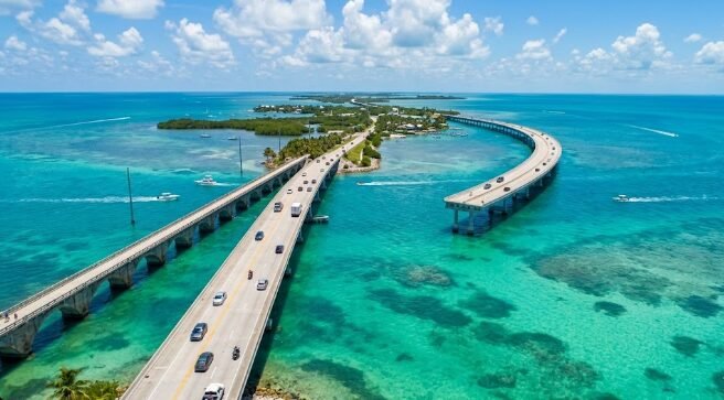
There’s a moment, usually somewhere around Islamorada, when the water on both sides of the road shifts to a blue so saturated it looks almost artificial — and that’s when most first-time visitors understand why the Overseas Highway has earned its nickname: the highway that goes to sea. This 113-mile stretch of U.S. Route 1 connects Key Largo to Key West across 42 bridges, hopping between islands with the Atlantic Ocean on one side and the Gulf of Mexico on the other for almost the entire drive.
This guide covers the complete route, current 2026 conditions, where to actually stop, and how to build a trip that doesn’t just race straight to Key West and miss everything in between. If you’re starting this drive from Miami, our complete Miami guide covers the gateway city in detail, and for a broader sense of how this compares to other iconic American drives, see our Pacific Coast Highway guide and Route 66 road trip guide.
Table of Contents
| Detail | Information |
|---|---|
| Route | U.S. Highway 1, Key Largo to Key West |
| Total Bridges Crossed | 42, including the famous Seven Mile Bridge |
| Toll Status | Completely toll-free |
| Speed Limit | Averages 45 mph, drops lower through individual Keys |
| Designation | Florida’s first and only All-American Road (since 2009) |
| Vehicle Requirements | None — fully paved, any standard car or rental works |
A Bit of History
The Overseas Highway follows a route originally blazed by Henry Flagler’s Florida Keys Over-Sea Railroad, completed in 1912 after seven years of construction. The railroad operated for just over two decades before a devastating Category 5 storm — the 1935 Labor Day Hurricane — destroyed a significant portion of the line, effectively ending rail service to the Keys. Three years later, the Overseas Highway opened, built partly on the surviving railroad infrastructure, including several of the original bridge spans still visible alongside the modern road today.
📖 Read More About Henry Flagler’s Florida Railroad →
Current 2026 Conditions and Practical Driving Notes
The Overseas Highway is fully paved, well-maintained, and requires no special vehicle — any standard rental car handles the route without issue. For most of the trip, US-1 runs one lane in each direction with limited passing sections, and traffic can slow significantly during peak season, so patience matters more than speed here.
Mile markers count down from 106 in Key Largo to 0 in Key West, and locals use them as the standard way to give directions — restaurants, hotels, and attractions are commonly identified by their mile marker (MM) number rather than a street address.
Fuel planning: prices climb the further south you go, so filling up in Key Largo or Islamorada before continuing saves money compared to waiting until Marathon or the Lower Keys.
Cell service: generally reliable, but expect occasional gaps between islands — download offline maps before departing, particularly if you’re relying on navigation through more remote stretches.
The Route, Region by Region
| Region | Mile Markers | Known For |
|---|---|---|
| Key Largo | MM 106-91 | Diving, John Pennekamp Coral Reef State Park |
| Islamorada | MM 90-70 | Sportfishing, beachfront dining |
| Marathon | MM 65-40 | Seven Mile Bridge, Turtle Hospital, central base |
| Lower Keys | MM 39-5 | Bahia Honda State Park, Key Deer Refuge |
| Key West | MM 4-0 | Southernmost Point, Old Town, sunset celebrations |
Key Largo: The Dive Capital of the World
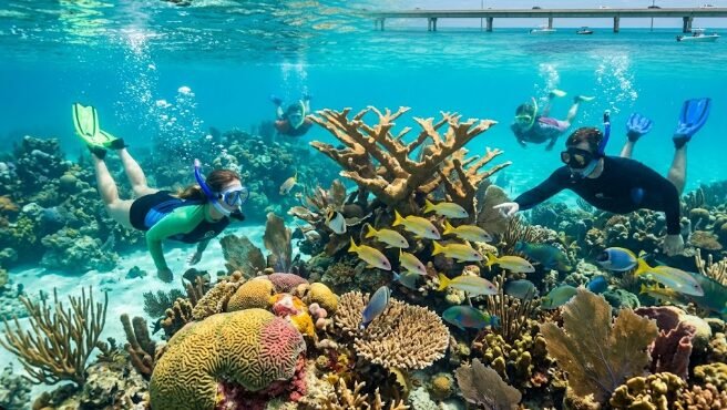
Key Largo’s self-given nickname is well-earned — John Pennekamp Coral Reef State Park, the first underwater park in the country, protects famous dive sites including Molasses Reef, where sea turtles, spotted rays, and reef sharks make regular appearances. Even non-divers can access the park’s glass-bottom boat tours for a reef view without getting wet.
🤿 Book a Key Largo Snorkel or Dive Tour →
Islamorada: Sportfishing and Sunset Dining
Known as the sportfishing capital of the Keys, Islamorada offers some of the best deep-sea fishing access in the region alongside beachfront restaurants like Lazy Days, where tables sit directly on the sand and tarpon and pelicans gather at the pier for feeding.
Marathon: The Practical Central Base
Sitting roughly at the midpoint of the route, Marathon makes a genuinely strong central base for a multi-night Keys trip — close enough to both the Upper and Lower Keys to minimize daily driving. The Turtle Hospital offers behind-the-scenes tours of its sea turtle rehabilitation work, and Sombrero Beach provides calm water and soft sand without an entrance fee.
The Seven Mile Bridge, the route’s most spectacular single feature, connects the Middle and Lower Keys here. Walk or bike a parallel section of the Old Seven Mile Bridge for close-up views without driving traffic, or watch the bridge from the patio at Sunset Grille & Raw Bar for one of the best sunset views in the entire Keys.
Lower Keys: Bahia Honda and Key Deer
Bahia Honda State Park, named for another historic Flagler-era railroad bridge, offers consistently ranked beaches with genuinely clear water — Calusa Beach is smaller and more protected, while Loggerhead Beach allows more room to spread out. An entrance fee applies, making this a strong spot to plan a full picnic-and-swim stop rather than a quick photo stop.
Nearby Big Pine Key is home to the endangered Key Deer, a small deer species found nowhere else on Earth. The National Key Deer Refuge Nature Center offers context, and driving slowly through the area gives you a genuinely good chance of spotting them — they’re commonly seen right along the roadside.
Key West: The End of the Road
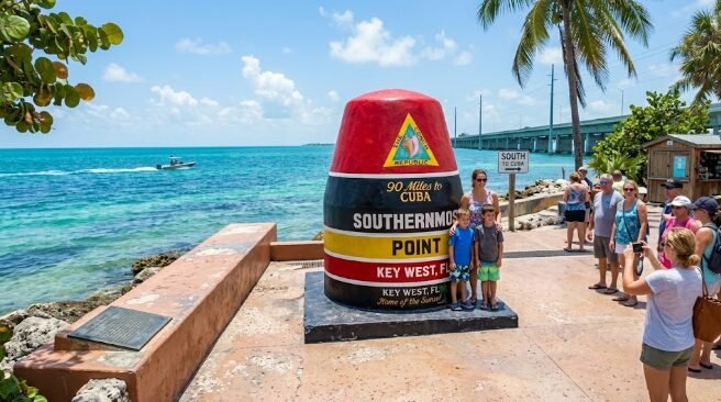
The Southernmost Point buoy, marking the southernmost point of the continental United States, draws long photo lines — visiting in late afternoon typically means a shorter wait. Beyond the photo stop, Key West’s Old Town offers the Hemingway Home, Fort Zachary Taylor State Park, and the nightly Mallory Square Sunset Celebration, a long-running tradition combining street performers with one of the most reliably spectacular sunset views in Florida.
🌅 Book a Key West Sunset Sail →
Key West also serves as the departure point for Dry Tortugas National Park, a remote island group 70 miles west, reachable only by ferry or seaplane — making it one of the least-visited national parks in the entire U.S. system, and a genuinely worthwhile day trip add-on if your schedule allows it.
Sample Itinerary: 5 Days, Key Largo to Key West
Day 1: Arrive Key Largo, snorkel or dive John Pennekamp Coral Reef State Park, overnight in Key Largo.
Day 2: Drive to Islamorada, sportfishing or beach time, sunset dinner, overnight in Islamorada.
Day 3: Continue to Marathon, Turtle Hospital tour, Seven Mile Bridge photo stop, overnight in Marathon.
Day 4: Bahia Honda State Park beach day, Key Deer spotting at Big Pine Key, continue to Key West, evening at Mallory Square.
Day 5: Key West Old Town exploration (Hemingway Home, Southernmost Point), optional Dry Tortugas day trip if extending your stay, or begin the return drive north.
For a longer, more relaxed version of this trip, our Pacific Coast Highway guide offers a useful comparison point — both are iconic American coastal drives, though the Keys trade Big Sur’s dramatic cliffs for a flatter, more laid-back island-hopping pace entirely framed by water rather than mountains.
Activities Beyond Driving
The Florida Keys Overseas Heritage Trail, a mostly car-free, bike-friendly path stretching over 100 miles roughly parallel to the highway, lets cyclists experience the route at a genuinely different pace, pedaling past historic landmarks and beaches without highway traffic.
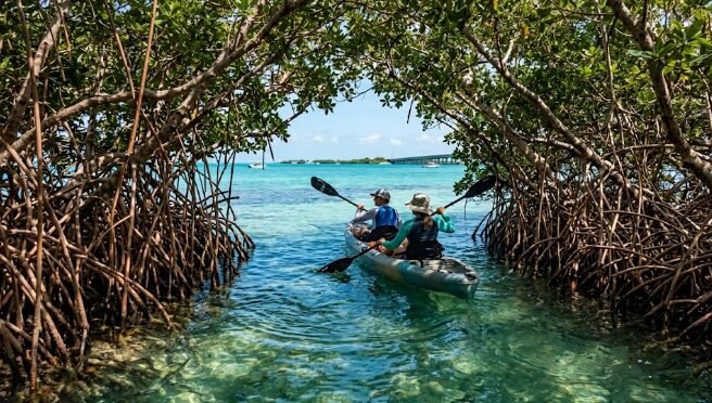
Kayaking through mangrove tunnels at Curry Hammock State Park offers a five-mile water trail through one of the Keys’ more ecologically significant habitats — these shallow, protected waters serve as nurseries for juvenile marine life and support nesting osprey, herons, and migratory falcons.
🚣 Book a Mangrove Kayak Tour →
Boat-accessible reef sites beyond Key Largo, including Sombrero Reef near Marathon and Looe Key near the Lower Keys, offer healthy coral formations for snorkelers and divers willing to book a boat tour rather than shore-diving alone.
Where to Stay: Comparison by Region
| Base Location | Best For | Drive to Key West |
|---|---|---|
| Key Largo | First/last night, diving focus | ~2.5 hours |
| Islamorada | Fishing, beachfront dining | ~2 hours |
| Marathon | Central base, minimal backtracking | ~1 hour |
| Key West | Old Town immersion, nightlife | On location |
🏨 Compare Florida Keys Hotels & Resorts →
Camping option: Bahia Honda State Park’s three campgrounds let you pitch a tent steps from the shoreline, while Long Key State Park offers a quieter, hike-in, tent-only experience with Atlantic Ocean views.
Best Time to Drive the Overseas Highway
Winter and Spring (December-May): The most popular window by far — warm temperatures, low humidity, clear skies, and hurricane season fully behind you. Book accommodations well ahead given this is genuine peak season.
Summer (June-August): Hot and humid with regular afternoon rain showers, but noticeably less crowded and often cheaper than winter peak rates.
Fall (September-November): The quietest season, but also peak hurricane risk, particularly in September — always check current storm forecasts before committing to fall travel dates in this specific region.
Wildlife of the Florida Keys
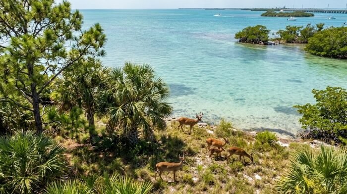
Beyond the famous Key Deer covered above, the Florida Keys support a genuinely diverse range of marine and bird life across the archipelago’s more than 1,700 islands — the vast majority uninhabited and protected by dense mangrove root systems. These shallow, calm waters function as nurseries for juvenile fish and marine life, while the dense foliage above water hosts nesting osprey, herons, and migratory peregrine falcons during seasonal passage.
Manatees are regularly spotted in calmer waters and marinas throughout the Keys, particularly during cooler months when they seek warmer, more sheltered water. Sea turtles nest on several Keys beaches during summer months, and the Turtle Hospital in Marathon, mentioned above, offers both rehabilitation work and genuine educational tours for visitors wanting to learn more about conservation efforts specific to the region.
What a Florida Keys Road Trip Costs
| Expense Category | Typical Cost Range |
|---|---|
| Mid-range hotel (per night, peak season) | $200-400 |
| Mid-range hotel (off-season) | $130-250 |
| Snorkel/dive tour | $50-100 per person |
| State park entrance fee | $4-8 per vehicle |
| Sunset sail or boat tour | $60-120 per person |
| Dry Tortugas ferry day trip | $190-220 per person |
A realistic budget for a 5-day Florida Keys road trip for two people during peak season, mixing mid-range lodging across multiple stops with a few paid activities like snorkeling and a sunset sail, typically lands in the $2,200-3,200 range, not including flights into Miami or Fort Lauderdale. Off-season travel (summer specifically) can reduce this by 25-35%, with the trade-off of heat, humidity, and afternoon rain.
Common Mistakes to Avoid
Rushing straight to Key West. Technically drivable from Miami in 3-3.5 hours, but doing so skips nearly everything that makes this route worthwhile — budget at least 3-4 days to actually stop along the way.
Not booking accommodations ahead during peak season. December through May genuinely fills up, and waiting until the last minute often means settling for far less desirable lodging or significantly higher rates.
Underestimating fuel costs in the Lower Keys. Prices climb the further south you travel — filling up in Key Largo or Islamorada before continuing saves real money over the course of the trip.
Treating Bahia Honda as a quick photo stop. Given the entrance fee, this park rewards a full visit — picnic, swim, or snorkel — rather than a five-minute drive-through.
Frequently Asked Questions
How long does it take to drive the Overseas Highway? Non-stop, about 3.5-4 hours from Miami to Key West. With reasonable stops and sightseeing, plan for 5-6 hours of actual driving time spread across your trip, ideally over 3-7 days total.
Is the Overseas Highway toll-free? Yes, completely — no tolls anywhere along the entire 113-mile route.
Do I need a special vehicle to drive the Florida Keys? No — the highway is fully paved and well-maintained, suitable for any standard rental car or personal vehicle. No 4WD or high clearance required.
Can I see Dry Tortugas National Park as a day trip? Yes, via ferry or seaplane departing from Key West, though this adds a full day to your itinerary given the 70-mile distance and limited departure schedule — worth planning specifically rather than as a spontaneous add-on.
What’s the best month for snorkeling visibility? Spring generally offers the clearest underwater visibility, combining the tail end of dry season conditions with water temperatures that haven’t yet hit summer’s more turbid patterns.
Final Thoughts
The Overseas Highway earns its All-American Road designation through a combination most other U.S. drives simply can’t replicate — genuine ocean on both sides for nearly the entire route, a laid-back island culture that feels meaningfully different from mainland Florida, and just enough history (Flagler’s railroad, the 1935 hurricane, the bridges that survived) to give the drive real depth beyond the scenery alone.
Slow down, plan real stops rather than racing to Key West, and the Florida Keys deliver one of the most genuinely relaxing road trips in the entire country — bucket-list worthy not because of any single dramatic landmark, but because of the cumulative, mile-after-mile experience of driving across open water toward the edge of the continental United States.